
Rinse and Repeat Pattern for the Next 5 Days
What you see is what you will get over the next several days across the Ohio Valley. Clouds, scattered showers and thunderstorms will settle into the region and be of an off and on nature through Tuesday. The responsible party will be a cut-off low that has decided to separate from the Polar jet stream up to the north and the subtropical jet to the south. With this set up there will be no steering currents to move this low in any direction which will result in the 5 days of rain chances for the Ohio Valley region.
Starting off with a bit of a review for Thursday, evidence of the impending storm was already being witnesses. High to mid level clouds have been streaming in from the north and west; a sign that moisture is already building into the region. The next step is for the mid level low to move closer to the Ohio Valley region aiding in lift and when sufficient enough rain will begin to fall in waves for the next several days.
Temperatures on Thursday reached the upper 60s to upper 70s as partial sunshine broke out from time to time but withe the increased cloud cover and rain threat temperatures should hold generally in the 60 to 65 degree range to the north and the 65 to 70 degree range in the south. Lows will follow the same process with not much spread, averaging in the upper 40s to low 50s in the north and low to mid 50s in the south. Wind will not be a huge factor since the region is under the cut off low so no real bite to the air is anticipated this weekend.
With this being the weekend some might ask if there is any chance of a dry period or two and the answer is yes but the problem is how long will the dry period be. That answer cannot be answered because the rain will come in waves. The threat of rain will be around almost at any time during the weekend so if you have outdoor plans be aware of the situation because if you happen to have something scheduled during the dry slot you will be able to get it in without too much fanfare. Basing the latest trends Saturday appears to be the drier of the two days for the upcoming weekend. If one of your destinations is to a local high school football game Friday night, the Ohio State Buckeyes game on Saturday afternoon. or the Cincinnati Bengals in town Sunday afternoon take along the rain gear because we all know unless there is thunder and lightning the game will go on.

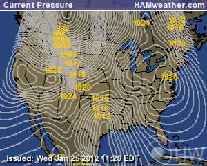
Monday Afternoon Upper Level Cut Off Low Still Over Ohio Valley; Courtesy of NCEP
For the beginning of the school and work week conditions will mirror the weekend. It appears by late Monday the low will begin to push east of the region as high pressure starts to nose in from the Midwest and Great Plains. While Monday and Tuesday will still be cloudy the shower threat begins to lower from West to East. By early Tuesday the western regions should begin to dry out and that will slide towards the eastern areas later in the day. All told 1.5-2″ of general rain should fall over the 5 day period with isolated bands of up to 3 inches possible.
On to brighter news, once this cut off low pushes east by late Tuesday into Wednesday great weather appears to be in the offing. We will actually see weather that is conduce for late September. Sunshine, pleasant afternoon temperatures and cool night time lows should stick around for several days. Temperatures generally in the 70s and lows in the upper 40s to middle 50s should be the rule for the Ohio Valley region but we have to make it through Tuesday in order to enjoy that stretch of weather.
One interest of note to the tropics is the disturbance off the Bahama Island coast. Many might have been reading about Typhoon Roke that slammed into Japan earlier this week. I am a teleconnection advocate of what happens in East Asia can translate to disturbed weather off the southeast United States in the Day 8 to 10 time frame. Currently a disorganized mess lies off the Bahama Coast. This disturbed weather could slowly transition into a tropical cyclone over the next several days as it meanders in the southwest Atlantic waters. This should be something to watch basing this off the teleconnection pattern so check in with the National Hurricane Center or other media sites to see how this evolves. My hunch is that it should develop into something but in a very slow manner.
For instant updates check me out at twitter @ http://twitter.com/OhioValleyWx or on facebook @ http://www.facebook.com/OVWeather
By Weather Specialist Josh Ketchen

You must be logged in to post a comment Login