
Heat About to Break, Storminess Ahead
The weather over the Ohio Valley the last 10 days has been quite warm but the humidity with all the rain the area received from March through mid May made it feel pretty rough at times. Most are probably getting worried that another hot and dry summer is in store for the area but that is just not the case.
Cold Front Position this Weekend; Courtesy of Accuweather
Trough Today; Courtesy of NCEP
Trough Position on Monday: Courtesy of NCEP
The last post I talked about how a tropical disturbance sitting in the Caribbean had to move out of the way to allow a trough to slide down into the eastern United States and that is the case. That tropical entity is moving into the northern Caribbean and should track up east of Florida over the next few days. This in turn will push the trough over Canada and the northern United States southward and usher in cooler temperatures by the end of the weekend and the start of the next work week.
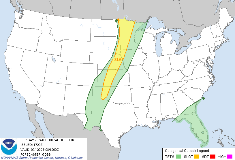
Friday Severe Risk; Courtesy of SPC
Saturday Severe Risk; Courtesy of SPC
With the proximity of the front over the Ohio Valley region the next 60 to 72 hours, shower and thunderstorms will be around through early Sunday morning. Whenever you have a sharp change in air masses from very warm to hot and very humid conditions south of the front and cooler and drier air to the north, severe thunderstorms are a threat. The main threat will be straight line winds and hail from the thunderstorms.
Upper Air Chart Tuesday Morning: Courtesy of NCEP
On Tuesday morning, the map shows how deep the trough is over the northeast and the northwest flow all across the Ohio Valley. This will allow the temperatures to cool into the mid 50s to near 60 at night and highs only reaching the upper 70s to near 80 for a few days. Go out and enjoy the 60 to 84 hour period because beyond Tuesday the risk of showers and thunderstorms come back. The cold front that comes through early on Sunday will sit over the northern Tennessee Valley and across the Mississippi Valley but begin to nudge northward as several waves will ride along the front the middle of next week and into the following weekend.
When a pattern like this occurs it is difficult to know when and where exactly storms will hit but the threat of a storm or two exists every day. One run will show heavy rain, the next run it will keep it dry, then tomorrow it will show rain again. Right now the best thing to do is to keep abreast of the weather each day. The bottom line though is that it will be cooler and wetter over the next 10 days then what the region has experienced the last 10 days.
Total Precipitation next 2 weeks; Courtesy of NCEP
As this map illustrates, 2 to as much as 5 or 6 inches of rain could fall over the region over the next couple of weeks. Currently it shows around 3 inches but since the track of thunderstorms and where fronts lie cannot be answered at the time generalizations have to be used. Also, thunderstorms can produce very heavy rain fall totals over a short period of time so totals in that regard could also rise.
Courtesy of freefoto.com
The bottom line is a stormier and cooler time is ahead for the Ohio Valley then what we just went through and flooding problems could be an issue again if thunderstorms train like they did in April.
By Weather Specialist Josh Ketchen
Keep it here at www.myweathertech.com for further updates.
Short URL: http://www.myweathertech.com/?p=1791


