
Warmest Part of Summer Over, Humid and Wet Takes Control
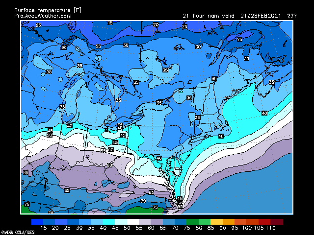
Sunday Temperatures; Courtesy of pro.accuweather.com
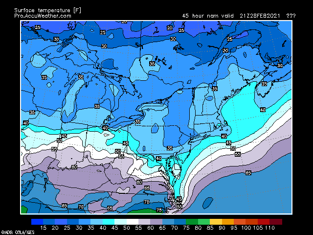
Monday Temperatures; Courtesy of pro.accuweather.com
The warmest ten dray stretch of the summer for the Ohio Valley has come to an end. While the area will still experience some very warm days, it appears that there will not be another stretch like this for the rest of the summer months. A cold front that is clearing the area now will usher in great weather for the next couple of days. Temperatures that have been running from the upper 80s to low and mid 90s with humid conditions will be replaced by temperatures in the middle 70s and low humidity. In a pattern that this region is in though, dry and comfortable can only last so long. As early as late Monday in the western regions and over the entire region by early Wednesday morning, showers and thunderstorms will return along with the humidity. The one thing that will be missing though is the heat.
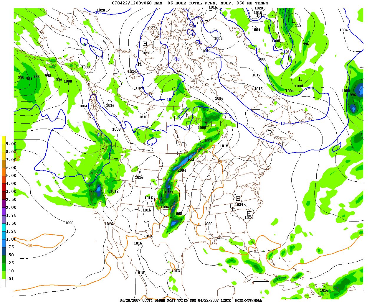
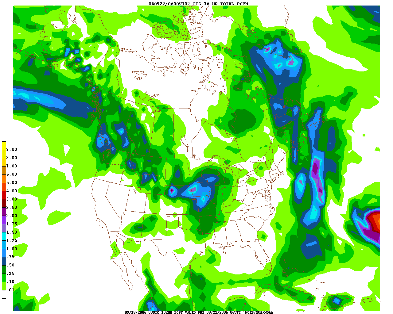
Tuesday Morning Rainfall; Courtesy of NCEP
As the map illustrates, an area of showers and thunderstorms will dump rainfall on the western parts of the Ohio Valley. With the heavy rainfall on Friday, some minor flooding is possible if the same areas receives one to two inches of rain from this event. After Tuesday though, the pattern gets challenging.
Mean Flow of the Atmosphere; Courtesy of NCEP
Taking a look at the flow of the atmosphere, the area is caught in between northwest flow from Canada and the deep upper-level low over New England. Depending on where the features line up, a wet Wednesday could be in store or another dry day with comfortable temperatures. Going to the surface map:
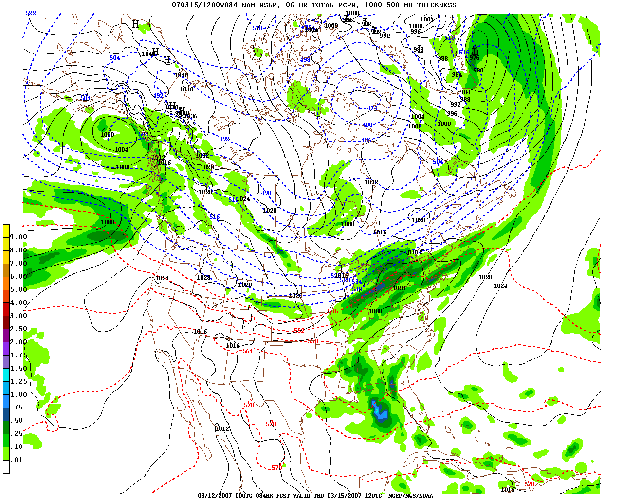
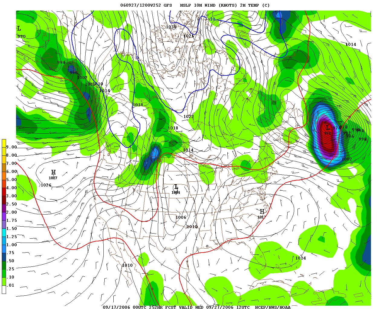
Surface Map Wednesday; Courtesy of NCEP
A low pressure will spawn between the heat to the southwest, the northwest flow from the Pacific and the trough off the New England coast. If the low moves more slowly then Wednesday could possibly be a dry and pleasant day with partly sunny skies and temperatures in the upper 70s to lower 80s; however, if the low moves more swiftly then the day could be a total washout with periods of rain and temperatures struggling to reach the low and middle 70s. Safe to say though by early Thursday morning, the majority of the Ohio Valley region will receive a very nice rainfall.
Rainfall of 1-2″ by Thursday Morning; Courtesy of NCEP
As we move towards the extended range, the weather appears to be shaping up as a stormy one. With what appears to be a wet Wednesday, the next several days will pose a threat for rain across the area. Scattered showers and thunderstorms will be possible for the following nine days. Now when that is said, fear and despair might enter the mind but on several days the rain will be isolated to scattered in nature. As is the case with thunderstorms, one area will get hammered while another area gets nothing. That is the type of pattern the region will be in.
Day 10 Mean Flow; Courtesy of NCEP
Day 10 Surface Map; Courtesy of NCEP
Looking at the maps, the reason the Ohio Valley could experience several days of on and off shower and thunderstorm activity is due to the fact that subtle moisture from a trough out west will be brought underneath a persistent northwest flow on top. Then you add subtle southerly winds transporting moisture from the Gulf of Mexico and all the cards are stacked for precipitation to break out across the region.
Total Precipitation Next 2 Weeks; Courtesy of NCEP
In total over the next couple of weeks 3 to as much as 6 inches of rain in widespread fashion will fall across the Ohio Valley. A key point that needs to be stressed is that this is just a general scale, in many cases with thunderstorms, areas in the region could see much more than what is being shown so flooding could be an issue in some spots that receive the greatest rainfall. An active time for the Ohio Valley is shaping up now that the heat has ended.
By Weather Specialist Josh Ketchen
Keep it here at www.myweathertech.com for further updates.
Short URL: http://www.myweathertech.com/?p=1809


