
“Indian Summer” Gone, Fall Storminess Returns
Hopefully many went out and enjoyed the last 10 days of mostly dry, mostly sunny, and pleasantly warm temperatures because that time is all but over. Temperatures for the next 5 days will not be too bad but after Monday any sustained warm temperatures seem to be over for the 2011 season. A cold front just off to the west will slowly make its way through the region late tonight through midday Friday. Rain has already fallen in the western and southwestern parts of the Ohio Valley and as it moves east it will slow and prolong the clouds and rain through most of Friday in the eastern sections. This brings up an issue that will be discussed momentarily.
First for Thursday expect clouds to remain thick with showers gradually overspreading the region from early morning in the west and late morning for central portions. The slow movement of this system might be able to make most of Thursday dry in far eastern sections. Since Wednesday was cloudy, damp, and rainy that will be justice since most all other areas were dry for Wednesday. Before the cold front moves through, a brief surge of subtle warmth will allow temperatures to push into the upper 60s to mid 70s in central and eastern portions of the Ohio Valley while places to the west that receive the rain overnight and first half of Thursday will remain in the 60s. Lows for the region tonight will stay above seasonal averages, generally in the middle 50s to near 60 degrees.
Friday appears to be a lot like Wednesday with dry conditions in the west and a chance of showers continuing in the east. The difference on Friday is that dry air will move in leading to more sunshine than what places saw for Wednesday. With some cold air aloft, some cumulus clouds will develop in the afternoon but it appears the air will be dry enough to prevent any showers. Thanks to the sunshine, temperatures will vary greatly with upper 60s to low 70s in the southwest and western areas with upper 50s to low 60s in eastern sections.
The pick of the weekend for the area will be Saturday with sunshine and comfortably cool but seasonal temperatures; however, a weak front passing through northern reaches of the region on Sunday could lead to clouds and a few showers for residents north of I-70. The threat is low but with outdoor plans it is advisable to at least mention the chance so you can be prepared in the event of a passing shower. Sunday night and most of Monday looks pleasant and dry before big changes begin.

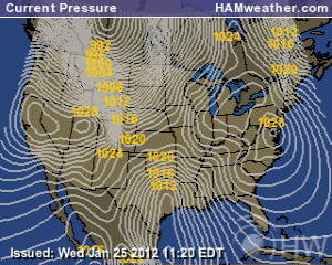
Strong Winds Just Above Surface Late Monday into Early Tuesday;Courtesy of NCEP
A very strong and aggressive cold front is expected to enter the western Ohio Valley late Monday and move through the majority of the region on Tuesday. With a strong low pressure to the north, winds in front will be screaming out of the south and southwest, yet behind the front strong westerly and northwesterly winds will be poised to rush in. With moderate shear values, the chance of severe weather has my attention. Wind and hail will be the main threats but t is too early for specifics at this time so I suggest tuning in over the weekend for an update.
Highs Next Wednesday Suggest Upper 40s to Low 50s for Most of Region; Courtesy of pro.accuweather.com
Of greater importance is the violent turn to colder weather. While it is still a bit early to use the word “shock cold” the perception might be exactly that on Tuesday and Wednesday. Temperatures running in the middle 60s to near 70 one day will greet most rudely on Tuesday with temperatures falling into the 50s with breezy conditions and there is a shot that on Wednesday most areas will struggle to climb much above 50 with clouds, drizzle, and blustery winds. Wind chills on Wednesday could be in the 30s for most of the day.
The big question is can a few flakes of snow fall on Wednesday night of next week? No simple answer can be given but the threat remains a possibility. The European model, a model I prefer to use in situations like this, suggest there could be a few flakes of snow. North American models right now are not sold on that idea so there is time to watch this evolve. A bigger key is the fact we are even talking about it in mid October is a sign of what will be coming soon enough.
In closing, if you like warm temperature try to soak it up because by this time next week it appears no sustained period of warmth is in store and when we do get brief warm shots it will often be followed quickly by a storm system and back to colder weather.
For instant updates check me out at twitter @ http://twitter.com/OhioValleyWx or on facebook @ http://www.facebook.com/OVWeather
By Weather Specialist Josh Ketchen

You must be logged in to post a comment Login