
Roller Coast Weather Takes Over as Change to Colder Settles In
Up and down, back and forth, forwards and backwards can be the main words to describe the weather pattern over the next couple of weeks. A surge to the middle 70s to middle 80s occurred Sunday but will be rudely replaced by middle 40s to middle 50s on Wednesday. Warm, strong southerly breezes in front of a passing cold front will gave way to biting north and northwest wind by Tuesday morning. Welcome to the Ohio Valley and what Autumn brings to this part of the country.
A relatively dry cold front is passing through the region as we speak. We often associate showers and thunderstorms with these fronts but the energy is lacking with this one. This could be a very key ingredient come winter but that will be explained later when the Ohio Valley Winter Weather Outlook is released at the end of the month. While a few areas received a few showers, the main action will come Monday night through Wednesday as a low pressure from the Gulf, likely a tropical storm, races into Florida and up the East Coast throwing rain back into the Ohio Valley. With the amount of warm waters lying just off the coast and cold air rushing in from Canada expect strong lows to form in the the Gulf, Southeast and Mid-Atlantic regions as we move deeper into the fall and winter seasons.
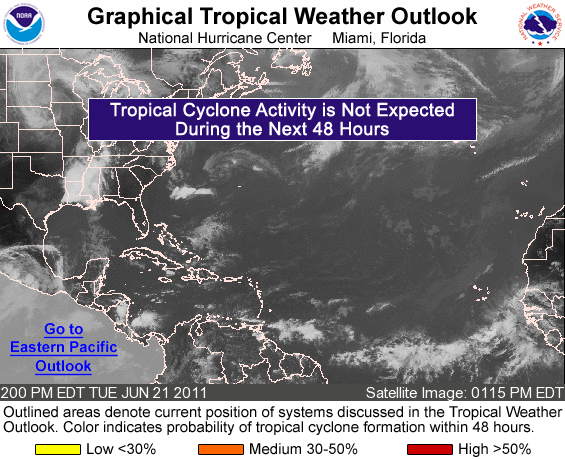
Disturbance Should Become Tropical Storm Rina in Next Day or Two; Courtesy of National Hurricane Center
Speaking of the tropics, and something I have been running into the ground, a low pressure is slowly rounding into form down in the Yucatan Peninsula. This should become Tropical Storm Rina and move into Florida late Tuesday evening then race up the east coast. More times then not when the pattern wants to change tropical influences get involved and this will be the case. Our nice stretch of mainly dry, relatively warm weather is coming to an end.

As we look into the following week for temperatures, Monday will be close to seasonal averages with temperature primarily in the 60s with partly to mostly cloudy skies. A few rain showers could enter the western reaches of the area by mid afternoon. As we head into Monday evening better rain chances develop and become likely by Tuesday as a piece of energy rotates through at the mid levels combined with the aforementioned tropical disturbance to the south. As the two pieces of energy combined over the east, a healthy baroclinic storm will develop leading to much colder air draining into our region. While Monday night lows fall generally in the middle 40s the real affect comes Tuesday as temperatures for most of the day stay in the upper 40s to low 50s. Highs on Tuesday could come at midnight and slowly fall through the afternoon. Wednesday will not be much better with morning lows in the upper 30s to low 40s with highs again remaining in the middle 40s to low 50s. We go from September on Sunday to mid November in 48 hours. This is the quintessential fall pattern we have come to love in our area.
Turning the attention to the potential of possibly a few flakes is still there but the chance is small. Temperatures appear to be just warm enough to eliminate the snow threat for this storm but it is not out of the question that a few flakes do fall somewhere in the region, especially off to the northwest. However, the call for seeing October snowflakes in the region is still a good bet.
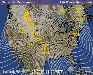
Potential Exists for a Cold Storm Late This Month; Courtesy of NCEP
While still over 10 days out, models such as the GFS and European, are suggesting a pretty significant storm that will be able to tap cold air and give the region a threat of a more modest threat for snow. It is too early to focus on specifics but even colder air is due in the middle of the week of the 24th with a storm forming over the southern Plains and trek east/northeastward. How all of this will play out will remain to be seen but taking a look at this week’s storm and the tendency for storm evolution to repeat itself, this storm should definitely be one to watch.
With all that being stated, the Ohio Valley Winter Weather Outlook is in the works as I type this. Several hard weeks and many hours of research has gone into this piece of work. A few more touches need to be added but it is coming along and will be out at the end of this month. Trust me you will want to stay tuned in for this because this winter should not be boring in the least. However, you have to wait a bit longer to know the inside scoop.
For instant updates check me out at twitter @ http://twitter.com/OhioValleyWx or on facebook @ http://www.facebook.com/OVWeather
By Weather Specialist Josh Ketchen

You must be logged in to post a comment Login