
We Will Have to “Dream” of a White Christmas This Year
The chances were there. I bought the kool-aid and drank it. I felt good about the chance but in the end, reality sets in and I have to shake my head in disappointment. In a crazy and extreme 2011, Christmas weather will be quite benign. Our threat of a “White Christmas” climatologically speaking are no better than 20 to 25 percent and the way December has been going any kind of brief winter weather precipitation would have been welcomed by many. It just is not in the cards.
A decent sized trough was anticipated to move right across the Ohio Valley on Christmas Day. With that trough came the threat of a period of light snow that had the potential to drop an inch or two of snow. This was not going to be a huge snow event to build snowmen but enough to whiten the ground for perhaps Christmas day. Even up through yesterday the threat of snow falling Saturday night into Sunday morning for a few hours still remained on the table but that has vanished. A piece of energy that will lie over Texas was supposed to move up in tandem with the northern stream to give parts of the Ohio Valley a chance of the white stuff, but the latest runs decided to keep the two streams separate, thus no snow.
A Dry Christmas Day This Year; Courtesy of NCEP
The result ends up being a dry and seasonal day. Expect temperatures to start out the day in the middle 20s to near 30 with highs climbing into the middle 30s to lower 40s. So travel problems in and around the region should be minimal, which is good news on that front but the scenery will not be at all wintry.

Getting back to the weather at hand for the present time, a line of showers with a cold front is sweeping through Ohio as this post is being written. Behind it windy and cooler conditions have settled in. Temperatures crept into the lower 60s prior to frontal passage but behind the front, temperatures have dropped back into the 40s on those brisk winds. Late tonight a wave of low pressure over the Gulf Coast states will develop and ride northeast along the cold front into tomorrow spreading rain back into the area. Expect rain to develop in the southwest reaches by mid morning and overtake the entire region by mid afternoon.
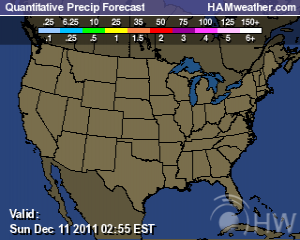
Moderate to Heavy Rain at Times for Thursday Afternoon into Evening; Courtesy of NCEP
Rainfall for Thursday will range between a third of an inch in the northwest to over an inch in the south. Lows will hover around 40 tonight then rise to the upper 40s to lower 50s. As we get late into tonight and Friday morning a mix of rain and snow will be possible in the northern and central portions of the Ohio Valley. It will not add up to anything but do not be surprised to see a few snowflakes mixed in with the rain drops. By Friday things will gradual clear out and dry up from west to east setting up the dry Holiday Weekend.
A quick glance past the Holiday Weekend into next week, the European model has suggested the threat of another storm system taking aim on the Ohio Valley region. In fact the 12Z guidance wants to blanket the area with some snowfall. With energy hanging back in Texas the threat is on the table and I will hone in and do my best to let you know what transpires over the next couple of days. Until then, enjoy yet more record setting rainfall.
For instant updates check me out at twitter @ http://twitter.com/OhioValleyWx or on facebook @ http://www.facebook.com/OVWeather
By Weather Specialist Josh Ketchen

You must be logged in to post a comment Login