Light Snow Tomorrow, Battle Friday Into Saturday
Winter returned to the region by the late afternoon hours of Tuesday and settled in Wednesday. With Tuesday starting off in the middle 50s to near 60 by sunset temperatures had fallen back into the lower and middle 30s. Thunderstorms, some tornadic in southern Indiana and western and central Kentucky, raked the area. Severe weather in January is rare but not uncommon; however, the intensity and number of tornadoes has been described as “Prolific” from the National Weather Service out of Louisville, Kentucky. Most were short lived, but the areas affected are certainly reeling from that event. Several wind damage reports also dotted the southern and western Ohio Valley, so hopefully the quiet Wednesday gave residence a chance to clean up and take care of certain issues.
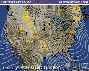
Wednesday featured more clouds than sun for northern areas while a bit more sun was found in places farther south. Temperatures hovered in the upper 20s for areas around Dayton, lower 30s in Cincinnati and Columbus, and middle 30s for Louisville. Lows tonight will fall into the upper teens to lower 20s but begin to rise in the overnight hours as another Arctic cold front barrels into the region for Thursday. Temperatures behind the front tonight are quite bitter. Places in the Dakotas, Minnesota, Iowa, and Wisconsin will drop into the -20s to perhaps the -30s for lows tonight. Add a stiff northwesterly winds and extremely dangerous wind chills of up to -50 below in spots could be realized. Back in our region with southerly winds temperatures will creep up into the low and middle 30s north of the river to perhaps near 40 in the southwest before the front slides through.
Light Snow Across Northern Areas for Thursday, Light Accumulations; Courtesy of NCEP
With the cold front strong southerly winds will occur but switch quickly to the west and northwest after the front passes through your area. Along with the front, light snow will break out primarily north of the Ohio River. South of the river a slight chance of sprinkles and flurries will exist. For areas from a Dayton to Indianapolis line and points north, an inch to locally two will be possible. From that line south towards Cincinnati a dusting to maybe a half an inch can be expected. No problems are anticipated but gusty winds and light precipitation might slow you down just a bit. By late Thursday evening, things dry up and temperatures fall into the lower and middle teens. The bigger issue lies with Friday night.
The massive storm that is bringing record snowfall to parts of the Pacific Northwest and tremendous rains along the Pacific coast will start to affect the region by the afternoon hours on Friday. With high pressure expected to be north of the system, a shallow layer of cold air will be stubborn to get out of the way. If northeast winds continually supply cold air, warm air advection will be prevented from dominating this system. This is an extremely difficult forecast because southern Ohio and south-central Indiana lie right on the dividing line.
Rain, Freezing Rain, Sleet, Snow All Possible For Region Friday PM into Saturday AM; Cortesy of NCEP
For western Kentucky and far southern Indiana potential for brief freezing rain is possible but by and large this will be a rain event. Problems begin once north of US 50. Depending on the depth of cold air, a sustained period of freezing rain could commence. With temperatures just below freezing, ice accretion will be limited but some treacherous spots will form. Areas closer to Indianapolis and Dayton could be in for a much more significant event. Potential lies for temperatures to hover in the upper 20s allowing for just cold enough profiles to create icing on most surfaces. The one caveat for places well north of I-70, precipitation could fall as primarily snow cutting down on the ice risk but upping snowfall accumulation potential.
This is a very fluid situation. I caution not to take this forecast as verbatim as things will change. The important message to take from the information provided is that the potential exists for some areas in the region to experience a moderate ice event. For places farther north a moderate snow event could be realized. My best advice is to stay tuned to local news media and other social media sources that provide updates on the impending weather.
As always for my latest thinking and updates on weather for the area check me out and follow me on twitter @ http://twitter.com/OhioValleyWx or on facebook @ http://www.facebook.com/OVWeather
By Weather Specialist Josh Ketchen


You must be logged in to post a comment Login